


ArCADia BIM: Automatically Created Spot Heights.
If we have a geodetic underlay in the dwg file format, we can use it to automatically create terrain in our project.
We start with rescaling our project from centimetres to meters. In the Project Manager window, right-click on the projection tab and select View properties and change the drawing units to Meters.
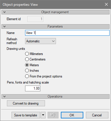
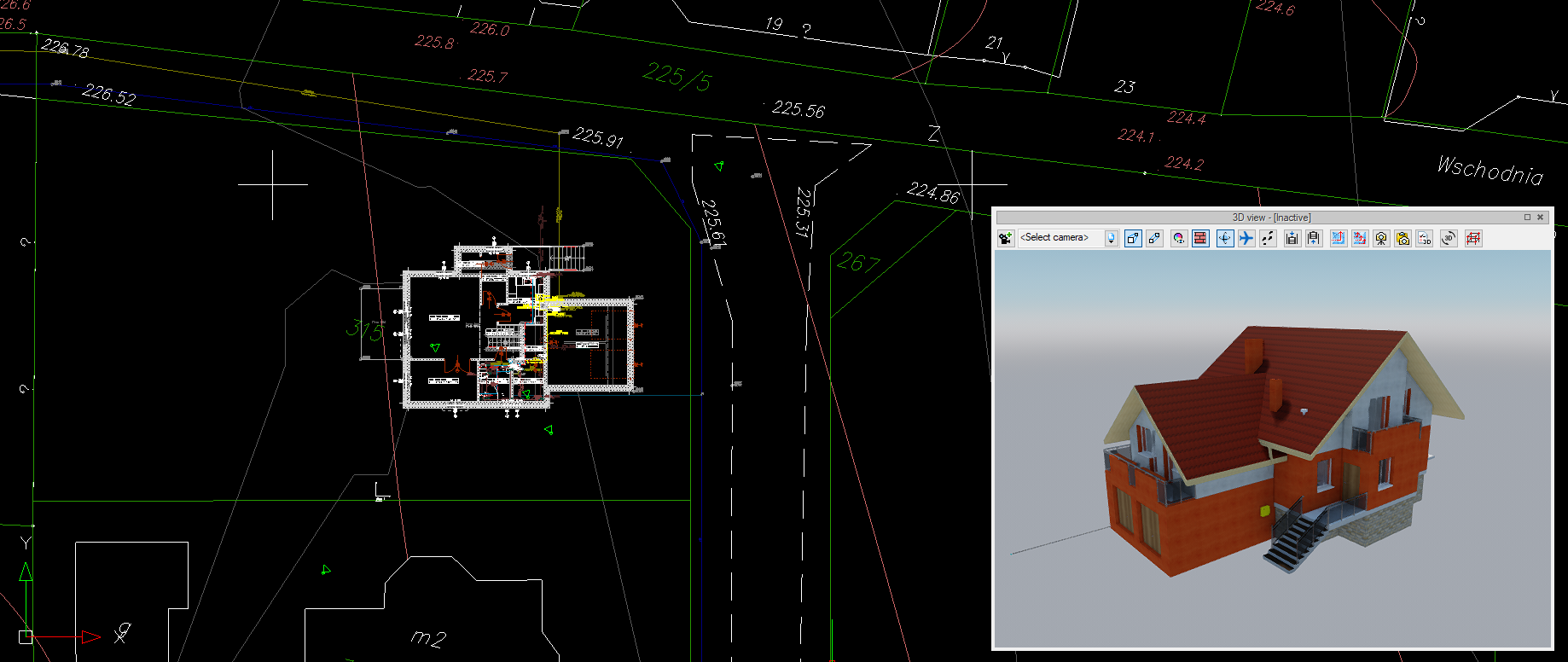
After approving the changes, the project will be drawn in the appropriate units. Now you can paste your project (preferably by copying it from another file). We move the building to its destination and check the spot heights on the map.
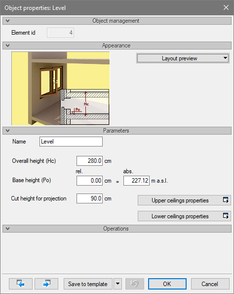
In the level properties window, you need to set the appropriate height of the building above the sea level.
After these operations, you turn on the Convert text into spot heights option.
![]()
We mark with the area the described spot heights on the map and confirm the selection.
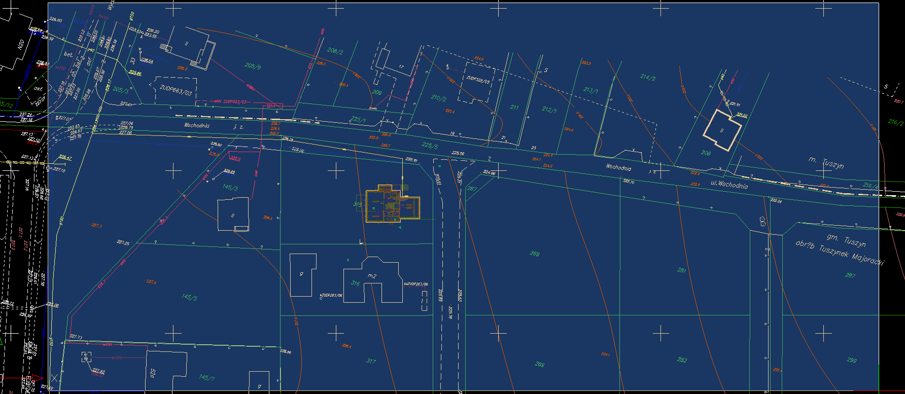
The terrain has been inserted.
Copyright © 2026 ArCADiasoft
HOME | PRODUCTS | COMPANY | CONTACT | FOR RESELLERS